Editor’s Note: This is part of a series called UChicago Class Visits, spotlighting transformative classroom experiences and unique learning opportunities offered at UChicago.
In previous fieldwork classes, geophysical scientist Susan Kidwell has taken students to the deserts of California or the fossil reefs of the Caribbean.
But while taking long walks during pandemic lockdowns, she stumbled on a landscape that had been practically next door all along: the 63rd Street Beach, just down the street from the University of Chicago.
“We were looking at a deteriorating seawall that turned out to date back to the Columbian Exposition. And on the beach, there were dunes, ripples, washovers. It was humans trying to control nature and nature fighting back. I thought, I could design a whole course around just this one beach,” said Kidwell, who is the UChicago William Rainey Harper Professor of Geophysical Sciences.
And that’s what she and Prof. Emeritus Michael LaBarbera did. This year is the third iteration of the course, which teaches geology and environmental science based on trips to the shoreline of the South Side of Chicago.
The coast was once shaped by the currents and eddies of a much larger Lake Michigan. Today it’s also shaped by the actions of humans, who have been rearranging the coast since the early days of Fort Dearborn, to the Columbian Exposition and the Illinois Central Railroad, and most recently to protect DuSable Lake Shore Drive.
All this history is written not just in books but in the lay of the land itself, Kidwell said.
“We’re trying to teach how to read a landscape and understand what you’re looking at. What combination of waves, wind, and machines created its features? Looking forward in time, where is this shore likely to be going?”
The world in a grain of sand
Thousands of years ago, the land where the University of Chicago now sits was underwater. The glacier-fed Lake Michigan was about 60 feet higher at that time, and as it receded gradually, it left behind old shorelines and sandy spits that have shaped the geography of modern-day Chicago.
You won’t see them right away, though.
“Almost no shoreline in the city of Chicago is natural,” LaBarbera told the students.
Much of the now-lakefront was man-made, formed by shoveling in rocks and debris, some of it left over from the Great Chicago Fire. For a course on coasts and coastal resilience, it’s a fascinating case study.
“You can still see 100-year-old timbers that marked the outline where they designed the shoreline and filled in behind it,” Kidwell said. “This highly successful 'Chicago style,' building out both to create public space and to protect the city, has become a model for the rest of the world.”
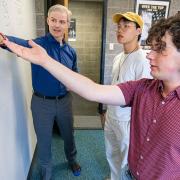
On one of the beach field trips, the students, bundled up against the chilly April weather, were instructed to choose a feature on the beach and hypothesize how it formed. One team chose a red rock resting in a pocket of sand on the shore; another, the ripples formed in the sand on the leeward side of a small dune. The students marked off measurements and sketched the scene, recording the continuity and amplitude of the sand ripples.
“In this exercise, you’re looking for patterns that help you see the processes and forces shaping the beach that you wouldn’t see or consider at first glance,” said Kidwell, whether that’s wind, water, time, or humans.
The students are also learning to develop intuition about physical properties, and to think like a scientist does—developing hypotheses and bouncing them off another round of observations, and eventually off more experienced people.
“We try to make it as much like real research as possible,” Kidwell said. “This is typical of how you would get a research project going. You notice something interesting. Then you pitch the idea for a project, like a scientist does to a funding agency. You do the work and give a talk to peers at a conference, you get feedback. You submit a paper, get feedback, revise and resubmit, all like I do. It becomes science.”
As the students hunched over their finds, sketching and measuring, Kidwell moved from group to group along the shore, asking questions and pointing out new angles.
She paused after leaving the group leaning over the little red rock. The image made her recall the William Blake poem, “Auguries of Innocence,” which begins: “To see a world in a grain of sand.”
“That’s geology!” Kidwell said.
‘One of the coolest classes’
As a final project, each student researches a shoreline that’s either in their hometown or 'close to their heart' in some way.
Using a variety of library and web sources, they produce a report on the geological and social history of the shore, as well as potential stresses and threats to it. This might include learning where its sediment comes from, what transformative storms affect it and what efforts are being made to improve its resilience.
“This is one of the coolest classes I’ve taken at UChicago,” said fourth-year undergraduate Phoebe Fingold. “It’s made me well-versed in understanding the natural and man-made processes that occur along a coastline, which is something quite applicable for someone from a major city on a coast.”
Fourth-year student Livia Zhu also finds knowledge from the class often coming to mind.
“Just going to a shoreline, you can look at changes people have made and deduce why,” Zhu said. “For example, looking around, you might see where someone has placed boulders where there’s high wave energy, to break it up. So even when it’s calm, you know what this beach is like at other times.”
This pleases Kidwell, who’s had this in mind all along.
“The aim is for every one of them to bore their own family to absolute tears about sand, gravel, and coastal resilience once they get home,” she said. “And, of course, to ‘rent, not buy’ on the shoreline unless they’ve studied things very, very carefully!”